Police forces have suborned the FAA into declaring a no-fly zone in a seven (7) mile radius of #NoDAPL camps in North Dakota.
Truthful video of unprovoked violence against peaceful protesters may “interfere with the election,” and/or their continuance of this cultural/environment/social outrage.
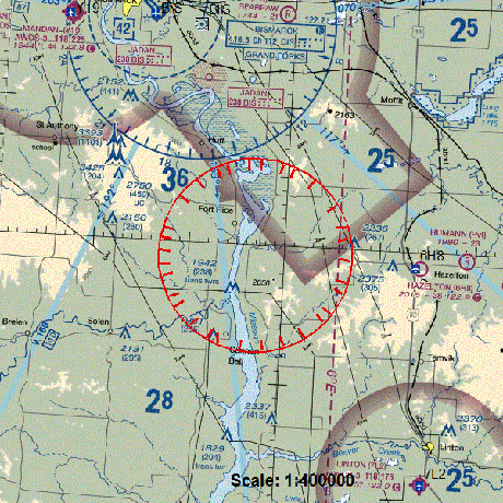
The FAA posted this helpful map:
James Peach reports contact information in FAA Issues “No Fly Zone” Over Area of DAPL Protests at Standing Rock, ND:
FAA Regional Office
Contact: Laurie Suttmeier
Telephone: (701)-667-3224“No Fly Zone” Notice –
FAA Temporary Flight RestrictionsMorton Country Sheriff’s Department
Facebook Page: Morton County Sheriff’s Department on FB
Contact: Sheriff Kyle Kirchmeier
Telephone: (701) 667-3330
In case you are behind on this particular government crime against a sovereign people and its own citizens, catch up with: The fight over the Dakota Access Pipeline, explained by Brad Plumer or, Life in the Native American oil protest camps (BBC).
The deployment of government forces is fluid so drones are essential to effective resistance.
And to capture and stream government atrocities in real time.
Small wonder the FAA is a co-conspirator in this criminal enterprise.