Another Word For It Patrick Durusau on Topic Maps and Semantic Diversity

December 21, 2015

Natural England opens-up seabed datasets

Filed under: Environment,Oceanography,Open Data — Patrick Durusau @ 7:10 pm

Natural England opens-up seabed datasets by Hannah Ross.

From the post:

Following the Secretary of State’s announcement in June 2015 that Defra would become an open, data driven organisation we have been working hard at Natural England to start unlocking our rich collection of data. We have opened up 71 data sets, our first contribution to the #OpenDefra challenge to release 8000 sets of data by June 2016.

What is the data?

The data is primarily marine data which we commissioned to help identify marine protected areas (MPAs) and monitor their condition.

We hope that the publication of these data sets will help many people get a better understanding of:

  • marine nature and its conservation and monitoring
  • the location of habitats sensitive to human activities such as oil spills
  • the environmental impact of a range of activities from fishing to the creation of large marinas

The data is available for download on the EMODnet Seabed Habitats website under the Open Government Licence and more information about the data can be found at DATA.GOV.UK.

This is just the start…

Throughout 2016 we will be opening up lots more of our data, from species records to data from aerial surveys.

We’d like to know what you think of our data; please take a look and let us know what you think at OpenData@naturalengland.org.uk.

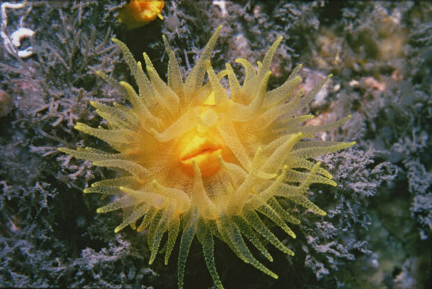
Image: Sea anemone (sunset cup-coral), Copyright (CC by-nc-nd 2.0) Natural England/Roger Mitchell 1978.

Great new data source and looking forward to more.

A welcome layer on this data would be, where possible, identification of activities and people responsible for degradation of sea anemone habitats.

Sea anemones are quite beautiful but lack the ability to defend against human disruption of those environment.

Preventing disruption of sea anemone habitats is a step forward.

Discouraging those who practice disruption of sea anemone habitats is another.

June 5, 2015

Global marine data to become unified, accessible

Filed under: Data Integration,Oceanography — Patrick Durusau @ 10:09 am

Global marine data to become unified, accessible

From the post:

An international project aims to enable the next great scientific advances in global marine research by making marine data sets more easily accessible to researchers worldwide.

Currently different data formats between research centres pose a challenge to oceanographic researchers, who need unified data sets to get the most complete picture possible of the ocean. This project, called ODIP II, aims to solve this problem using NERC’s world-class vocabulary server to ‘translate’ between these different data semantics. The vocabulary server, which is effectively now an international standard for a service of this kind, was developed by the British Oceanographic Data Centre (BODC); a national facility operated as part of the National Oceanography Centre (NOC).

That sounds promising, at least until you read:

By the time ODIP II is complete, in May 2018, it aims to have developed a means of seamlessly sharing and managing marine data between the EU, the USA and Australia, by co-ordinating the existing regional marine e-infrastructures.

I’ve never been really strong on geography but the last time I looked, “global” included more than the EU, USA and Australia.

Let’s be very generous and round the EU, USA and Australia population total up to 1 billion.

That leaves 6 billion people and hundreds of countries unaccounted for. Don’t know but some of those countries might have marine data. Won’t know if we don’t ask.

Still a great first step, but let’s not confuse the world with ourselves and what we know.

October 10, 2014

Super-Detailed Interactive 3-D Seafloor Map

Filed under: Mapping,Maps,Oceanography — Patrick Durusau @ 9:47 am

Super-Detailed Interactive 3-D Seafloor Map by Nick Stockton.

From the post:

This super-detailed map of the ocean floor’s topography is based on satellite measurements of subtle lumps on the ocean’s surface. These lumps of water, which are subtle, low, and wide on the ocean’s surface, are caused by the gravitational pull of underwater features like mountains and ridges. The team of scientists wrapped their data around a Google Earth globe, so you and I could explore it ourselves, in the visualization above.

The map has more than twice the resolution of previous seafloor maps, and shows a plethora of never-before-seen features. These include thousands of volcanoes and what could be the ridge where two plates pulled apart to create the Gulf of Mexico. The map is part of new research published last week in Science.

The visualization at the top of the page (click here for a full screen view) lets you play with the vertical exaggeration of both continental and subsea topography using the upper left drop-down menu. (They might seem huge to us at ground level, but the planet’s mountains and valleys are almost imperceptible from the vantage of space.) Another visualization of the study’s map lets you drag a time bar to simulate the movement of tectonic plates.

Great seafloor map and visualization techniques!

Read Nick’s post to get some background on “gravitational mapping.” In short, gravitational mapping relies on the impact of features of the seafloor on ocean height to create detailed seafloor maps.

Sounds like very interesting data sets with many discoveries left to be made.

September 9, 2014

OceanColor Web

Filed under: NASA,Oceanography — Patrick Durusau @ 7:36 pm

OceanColor Web

A remarkable source for ocean color data and software for analysis of that data.

From the webpage:

This project creates a variety of established and new ocean color products for evaluation as candidates to become Earth Science Data Records.

Not directly relevant to anything I’m working on but I don’t know what environmental or oceanography projects you are pursuing.

I first saw this in a tweet by Rob Simmon.

December 22, 2013

…2013 World Ocean Database…

Filed under: Government Data,Oceanography,Science — Patrick Durusau @ 4:44 pm

NOAA releases 2013 World Ocean Database: The largest collection of scientific information about the oceans

From the post:

NOAA has released the 2013 World Ocean Database, the largest, most comprehensive collection of scientific information about the oceans, with records dating as far back as 1772. The 2013 database updates the 2009 version and contains nearly 13 million temperature profiles, compared with 9.1 in the 2009 database, and just fewer than six million salinity measurements, compared with 3.5 in the previous database. It integrates ocean profile data from approximately 90 countries around the world, collected from buoys, ships, gliders, and other instruments used to measure the “pulse” of the ocean.

Profile data of the ocean are measurements taken at many depths, from the surface to the floor, at a single location, during the time it takes to lower and raise the measuring instruments through the water. “This product is a powerful tool being used by scientists around the globe to study how changes in the ocean can impact weather and climate,” said Tim Boyer, an oceanographer with NOAA’s National Oceanographic Data Center.

In addition to using the vast amount of temperature and salinity measurements to monitor changes in heat and salt content, the database captures other measurements, including: oxygen, nutrients, chlorofluorocarbons and chlorophyll, which all reveal the oceans’ biological structure.

For the details on this dataset see: WOD Introduction.

The introduction notes under 1.1.5 Data Fusion:

It is not uncommon in oceanography that measurements of different variables made from the same sea water samples are often maintained as separate databases by different principal investigators. In fact, data from the same oceanographic cast may be located at different institutions in different countries. From its inception, NODC recognized the importance of building oceanographic databases in which as much data from each station and each cruise as possible are placed into standard formats, accompanied by appropriate metadata that make the data useful to future generations of scientists. It was the existence of such databases that allowed the International Indian Ocean Expedition Atlas (Wyrtki, 1971) and Climatological Atlas of the World Ocean (Levitus, 1982) to be produced without the time-consuming, laborious task of gathering data from many different sources. Part of the development of WOD13 has been to expand this data fusion activity by increasing the number of variables that NODC/WDC makes available as part of standardized databases.

As the NODC (National Oceanographic Data Center) demonstrates, it is possible to curate data sources in order to present a uniform data collection.

But curated data set remains inconsistent with data sets not curated by the same authority.

And combining curated data with non-curated data requires effort with the curated data, again.

Hard to map towards a destination without knowing its location.

Topic maps can capture the basis for curation, which will enable faster and more accurate integration of foreign data sets in the future.

February 1, 2013

Ocean Biogeographic Information System (OBIS)

Filed under: Biology,Oceanography — Patrick Durusau @ 8:04 pm

Ocean Biogeographic Information System (OBIS)

Someone suggested to me recently that pointers to data for topic maps would be quite useful.

In the vein, consider the records held by the OBIS system:

Below is an overview of some of the vital statistics of OBIS, including number of records available through the search interface, number of species and number of datasets; the numbers between brackets are those for the last two data loads, and show progress booked since then. The graph shows how the number of records increased over time.

  • Number of records: 35.5 (33.6, 32.7, 32.3) million
    • Number of records identified to species or infraspecies: 27.32 (26.3, 25.52, 25.19) million
    • Number of records identified to genus or better: 31.1 (29.8, 28.5, 28.4) million
  • Number of valid species with data reported to OBIS: 146,496 (145,899; 145,317; 145,153)
  • Number of valid marine taxa in OBIS: 163,313 (162,139; 161,620; 161,493)
    • Number of valid marine species: 120,259 (119,337; 118,937; 118,801)
    • Number of valid marine genera: 27,333 (27,228; 27,154; 27,086)
  • Number of datasets: 1,130 (1,125; 1,072; 1,056)

Talk about an opportunity to integrate data into the historical records of marine biology!

Powered by WordPress