Mapping the History of L.A.’s Notorious Sprawl by Betsy Mason.
From the post:
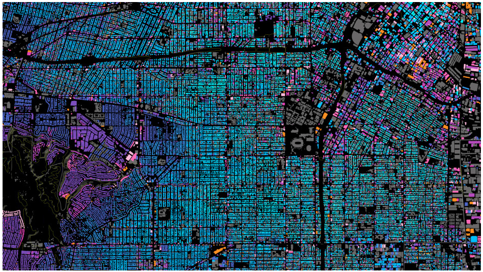
(Apologies for the distortion, the map really needs a full page and to be seen when interactive.)
From the post:
THE SPRAWLING BUILTSCAPE of Los Angeles always seems to have people there riled up in one way or another. Lately there are rumblings about “classic” L.A. homes being displaced by bigger, more modern houses, changing the face of established neighborhoods. Even people with enormous mansions are complaining about the enormouser mansions people are building next door. And this is just one of the ongoing storylines in an ever-morphing city.
Now, urban designer Omar Ureta has created an interactive map to help tell some of these stories. His Built:LA project shows the ages of almost every existing building in the city, and can break them down by decade to reveal how the city has grown over time (works best in Chrome or Firefox).
“There’s so much discussion going on right now in how L.A. is urbanizing, I wanted to create a tool that could contribute to the dialogue,” Ureta, who moved to L.A. nine years ago from the Inland Empire, told me in an email. “I’m excited that the map is actually making people ask more questions about their neighborhood, their city and the whole region.”
…
Ureta’s combining of data from a variety of sources enables users to peel back layers of construction in L.A. Makes me curious about forward looking “what-if” maps based on local history of development?
This project should be an inspiration for either historical or future projecting maps of urban construction.