I first saw this on Instagram at: https://instagram.com/p/363b2lOpn7/ with the following comment:
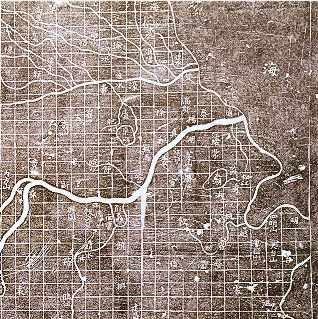
Map of the Tracks of Yu, 1136, is the first known map to use a cartographic grid.
The David Rumsey Map Collection, Cartography Associates, offers this more complete image from the Harvard Fine Arts Library:
And the following blurb:
Yujitu (Map of the Tracks of Yu), 1136. This map’s title derives from the Yugong, a treatise describing the sage-king Yu’s mythical channeling of China’s rivers. It is a rare surviving example of cartography used in the 12th century for public education, mixing classical references with later administrative history. Carved on a large stone tablet so that students or visitors could make rubbings, the map strikingly depicts a riverine network on a regular grid of squares intended to represent 100 li to a side. Read a more detailed description of this map by Alexander Akin, Ph.D. View the map in Google Earth. The image is courtesy Harvard Fine Arts Library.
To temp you into further reading, Alexander Akin’s description opens with these lines:
The Yijitu (Map of the Tracks of Yu) is the earliest extant map based on the Yugong (introduced below). Engraved in stone in 1136, the map measures about one meter to a side. It was carved into the face of an upright monument on the grounds of a school in Xi’an so that visitors could make detailed rubbings using paper and ink. These rubbings could be taken away for later reference. The stone plaque thus functioned as something like an immovable printing block, remaining in Xi’an while copies of its map found their way further afield. Harvard University holds one such rubbing made from the original stone, and has generously granted permission for the use of this unusually clear image, which shows more detail than any previously published version….
Alexander struggles, as only a modern would, over the “accuracy” of the map. A map that at times accords with the findings of modern map makers and at times accords with its Confucian heritage.
With maps in general and topic maps in particular, a question of “accuracy” cannot be answered with being supplied with the measurement to be applied in answering that question.

