Another Word For It Patrick Durusau on Topic Maps and Semantic Diversity

June 13, 2016

Wrigley Field: 1060 W Addison St, Chicago, IL or digits.bucked.talent? (3-Word Addresses)

Filed under: GeoNames,Georeferencing,Government,Mapping,Maps — Patrick Durusau @ 8:51 pm

Elwood Blues says in The Blues Brothers that he falsified his drivers license renewal and listed:

“1060 W. Addision”

as his home address, somehow

digits.bucked.talent

doesn’t carry the same impact. Yes?

Mongolia has places as familiar as Wrigley Field is to Americans but starting next month, all locations in Mongolia are going to have three-word phrase addresses. Mongolia is changing all its addresses to three-word phrases by Joon Ian Wong.

From the post:

Mongolia will become a global pioneer next month, when its national post office starts referring to locations by a series of three-word phrases instead of house numbers and street names.

The new system is devised by a British startup called What3Words, which has assigned a three-word phrase to every point on the globe. The system is designed to solve the an often-ignored problem of 75% of the earth’s population, an estimated 4 billion people, who have no address for mailing purposes, making it difficult to open a bank account, get a delivery, or be reached in an emergency. In What3Words’ system, the idea is that a series of words is easier to remember than the strings of number that make up GPS coordinates. Each unique phrase corresponds to a specific 9-square-meter spot on the map.

For example, the White House, at 1600 Pennsylvania Avenue, becomes sulk.held.raves; the Tokyo Tower is located at fans.helpless.collects; and the Stade de France is at reporter.smoked.received.

Mongolians will be the first to use the system for government mail delivery, but organizations including the United Nations, courier companies, and mapping firms like Navmii already use What3Words’ system.

The most remarkable aspect of the https://map.what3words.com/ is revealed if you try for:

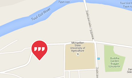
Gandan Monastery (Gandantegchinlen Khiid), Gandan Monastery District, Ulaanbaatar 16040 (011 36 0354).

Use this URL: https://map.what3words.com/Gandantegchenlen+Khiid+Ulaanbaatar+Mongolia

mongolia-map-460

Now try changing languages (upper-right).

Three-word phrase addresses for the Gandan Monastery:

  • picturing.backfired.riverside (English)
  • schneller.juwelen.schaffen (German)
  • aislados.grifo.acuerde (Spanish)
  • nuageux.lémurien.rejouer (French)
  • turbato.fotografate.tinozza (Italian)
  • chinelo.politicar.molhada (Portugese
  • matte.skivar.kasta (Swedish)
  • vücudu.ırmak.peşini (Turkish)
  • карьера.слог.шелка (Russian)

I have only had time to spot check the site but did find retraced.loudest.teaspoon for Yap Island in Micronesia.

More obscure places to try?

You can find a wealth of additional information, yes, including an API at: http://what3words.com/.

A great opportunity for topic maps as previous ways of identifying locations are not going to wink out of existence. If 3-word addresses catch on, use of other locators may dwindle but that will be over generations. We are facing a very long transition period.

Thoughts on weaponizing 3-word addresses. First, using the wrong 3-word addresses to mis-lead agents of the state. Second, creating new 3-word addresses that can be embedded prose, song, without the dot separators.

Not to mention a server with proper authentication, returns the “correct” map location for a 3-word address, otherwise, you get the standard one.

Enjoy!
October 10, 2013

Geocode the world…

Filed under: Geographic Data,Geography,GeoNames,Maps — Patrick Durusau @ 3:29 pm

Geocode the world with the new Data Science Toolkit by Pete Warden.

From the post:

I’ve published a new version of the Data Science Toolkit, which includes David Blackman’s awesome TwoFishes city-level geocoder. Largely based on data from the Geonames project, the biggest improvement is that the Google-style geocoder now handles millions of places around the world in hundreds of languages:

Who or what do you want to locate? 😉

May 26, 2013

CLAVIN [Geotagging – Some Proofing Required]

Filed under: Geography,GeoNames,Georeferencing,Maps — Patrick Durusau @ 10:21 am

CLAVIN

From the webpage:

CLAVIN (*Cartographic Location And Vicinity INdexer*) is an open source software package for document geotagging and geoparsing that employs context-based geographic entity resolution. It combines a variety of open source tools with natural language processing techniques to extract location names from unstructured text documents and resolve them against gazetteer records. Importantly, CLAVIN does not simply “look up” location names; rather, it uses intelligent heuristics in an attempt to identify precisely which “Springfield” (for example) was intended by the author, based on the context of the document. CLAVIN also employs fuzzy search to handle incorrectly-spelled location names, and it recognizes alternative names (e.g., “Ivory Coast” and “Côte d’Ivoire”) as referring to the same geographic entity. By enriching text documents with structured geo data, CLAVIN enables hierarchical geospatial search and advanced geospatial analytics on unstructured data.

See http://clavin.bericotechnologies.com/ for an online demo, videos and other materials.

Your mileage may vary.

I used a quote from today’s New York Times (Rockets Hit Hezbollah Stronghold in Lebanon):

An ongoing battle in the Syrian town of Qusair on the Lebanese border has laid bare Hezbollah’s growing role in the Syrian conflict. The Iranian-backed militia and Syrian troops launched an offensive against the town last weekend. After dozens of Hezbollah fighters were killed in Qusair over the past week and buried in large funerals in Lebanon, Hezbollah could no longer play down its involvement.

Col. Abdul-Jabbar al-Aqidi, commander of the Syrian rebels’ Military Council in Aleppo, appeared in a video this week while apparently en route to Qusair, in which he threatened to strike in Beirut’s southern suburbs in retaliation for Hezbollah’s involvement in Syria.

“We used to say before, ‘We are coming Bashar.’ Now we say, ‘We are coming Bashar and we are coming Hassan Nasrallah,'” he said, in reference to Hezbollah’s leader.

“We will strike at your strongholds in Dahiyeh, God willing,” he said, using the Lebanese name for Hezbollah’s power center in southern Beirut. The video was still online on Youtube on Sunday.

Hezbollah lawmaker Ali Ammar said the incident targeted coexistence between the Lebanese and claimed the U.S. and Israel want to return Lebanon to the years of civil war. “They want to throw Lebanon backward into the traps of civil wars that we left behind,” he told reporters. “We will not go backward.”

The results from CLAVIN:

Locations Extracted and Resolved From Text

ID Name Lat, Lon Country Code #
272103 Lebanon 33.83333, 35.83333 LB 3
6951366 Lebanese 44.49123, 26.0877 RO 3
276781 Beirut 33.88894, 35.49442 LB 2
162037 Dahiyeh 38.19023, 57.00984 TM 1
6252001 U.S. 39.76, -98.5 US 1
103089 Qusair 25.91667, 40.45 SA 1
163843 Syria 35, 38 SY 1
163843 Syrian 35, 38 SY 1
294640 Israel 31.5, 34.75 IL 1
170062 Aleppo 36.25, 37.5 SY 1

(The highlight added to show incorrect resolutions.)

FYI:

RO = Romania

SA = Saudia Arabia

TM = Turkmenistan

Plus “Qusair” appears twice in the quoted text.

For the ten locations mentioned a seventy (70%) percent accuracy rate.

Better than the average American but proofing is still an essential step in editorial workflow.

I first saw this in Pete Warden’s Five short links.

March 30, 2013

gvSIG

gvSIG

I encountered the gvSIG site while tracking down the latest release of i3Geo.

From its mission statement:

The gvSIG project was born in 2004 within a project that consisted in a full migration of the information technology systems of the Regional Ministry of Infrastructure and Transport of Valencia (Spain), henceforth CIT, to free software. Initially, It was born with some objectives according to CIT needs. These objectives were expanded rapidly because of two reasons principally: on the one hand, the nature of free software, which greatly enables the expansion of technology, knowledge, and lays down the bases on which to establish a community, and, on the other hand, a project vision embodied in some guidelines and a plan appropriate to implement it.

Some of the software projects you will find at gvSIG are:

gvSIG Desktop

gvSIG is a Geographic Information System (GIS), that is, a desktop application designed for capturing, storing, handling, analyzing and deploying any kind of referenced geographic information in order to solve complex management and planning problems. gvSIG is known for having a user-friendly interface, being able to access the most common formats, both vector and raster ones. It features a wide range of tools for working with geographic-like information (query tools, layout creation, geoprocessing, networks, etc.), which turns gvSIG into the ideal tool for users working in the land realm.

gvSIG Mobile

gvSIG Mobile is a Geographic Information System (GIS) aimed at mobile devices, ideal for projects that capture and update data in the field. It’s known for having a user-friendly interface, being able to access the most common formats and a wide range of GIS and GPS tools which are ideal for working with geographic information.

gvSIG Mobile aims at broadening gvSIG Desktop execution platforms to a range of mobile devices, in order to give an answer to the needings of a growing number of mobile solutions users, who wish to use a GIS on different types of devices.

So far, gvSIG Mobile is a Geographic Information System, as well as a Spatial Data Infrastructures client for mobile devices. Such a client is also the first one licensed under open source.

I3Geo

i3Geo is an application for the development of interactive web maps. It integrates several open source applications into a single development platform, mainly Mapserver and OpenLayers. Developed in PHP and Javascript, it has functionalities that allows the user to have better control over the map output, allowing to modify the legend of layers, to apply filters, to perform analysis, etc.

i3Geo is completely customizable and can be tailor to the different users using the interactive map. Furthermore, the spatial data is organized in a catalogue that offers online access services such as WMS, WFS, KML or the download of files.

i3Geo was developed by the Ministry of the Environment of Brazil and it is actually part of the Brazilian Public Software Portal.

gvSIG Educa

What is gvSIG Educa?

“If I can’t picture it, I can’t understand it (A. Einstein)”

gvSIG Educa is a customization of the gvSIG Desktop Open Source GIS, adapted as a tool for the education of issues that have a geographic component.

The aim of gvSIG Educa is to provide educators with a tool that helps students to analyse and understand space, and which can be adapted to different levels or education systems.

gvSIG Educa is not only useful for the teaching of geographic material, but can also be used for learning any subject that contains a spatial component such as history, economics, natural science, sociology…

gvSIG Educa facilitates learning by letting students interact with the information, by adding a spatial component to the study of the material, and by facilitating the assimilation of concepts through visual tools such as thematic maps.

gvSIG Educa provides analysis tools that help to understand spatial relationships.

Definitely a site to visit if you are interested in open source GIS software and/or projects.

May 23, 2012

New UMBEL Release Gains schema.org, GeoNames Capabilities

Filed under: Geographic Data,GeoNames,Schema.org,UMBEL — Patrick Durusau @ 2:12 pm

New UMBEL Release Gains schema.org, GeoNames Capabilities by Mike Bergman.

From the post:

We are pleased to announce the release of version 1.05 of UMBEL, which now has linkages to schema.org [6] and GeoNames [1]. UMBEL has also been split into ‘core’ and ‘geo’ modules. The resulting smaller size of UMBEL ‘core’ — now some 26,000 reference concepts — has also enabled us to create a full visualization of UMBEL’s content graph.

Mapping to schema.org

The first notable change in UMBEL v. 1.05 is its mapping to schema.org. schema.org is a collection of schema (usable as HTML tags) that webmasters can use to markup their pages in ways recognized by major search providers. schema.org was first developed and organized by the major search engines of Bing, Google and Yahoo!; later Yandex joined as a sponsor. Now many groups are supporting schema.org and contributing vocabularies and schema.

You will appreciate the details of the writeup and like the visualization. Quite impressive!

PS: As if you didn’t know:

http://umbel.org/

This is the official Web site for the UMBEL Vocabulary and Reference Concept Ontology (namespace: umbel). UMBEL is the Upper Mapping and Binding Exchange Layer, designed to help content interoperate on the Web.

Powered by WordPress