Mapping Fossil Fuel Resistance
An interactive map of groups resisting fossil fuel pipelines, which appears US-centric to me.
What do you think?
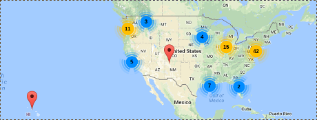
If you check the rest of the map, no groups at other locations, at least not yet.
The distribution of protests is sparse, considering the number of pipelines in the US:
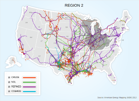
Pipeline image from: Pipeline 101 – Where Are Liquids Pipelines Located?.
Maps of pipelines, for national security reasons, are limited in their resolution.
I’m not sure how effective limiting pipeline map resolution must be since Pipeline 101 -How Can You Identify Pipelines?, gives these examples:
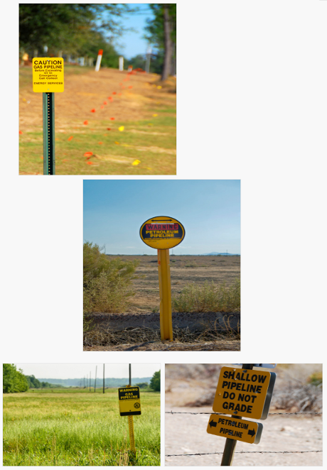
You get close enough from a “security minded” pipeline map and then drive until you see a long flat area with a pipeline sign. That doesn’t sound very hard to me. You?
Possible protest activity. Using the GPS on your phone, record locations where pipelines cross highways. Collaborate on production of GPS-based pipeline maps. Free to the public (including protesters).
We have the technology. Do we have the will to create our own maps of pipeline locations?