Mapbox: Innovating with Landsat by Larisa Serbina and Holly Miller.
From the post:
Mapbox* is a cloud-based map platform startup that creates custom maps with open source tools. The team at Mapbox consists of over fifty cartographers, data analysts and software engineers, located in Washington, D.C. and San Francisco, California. One of the open-source tools used by Mapbox is Landsat imagery. The company has a satellite team consisting of five employees dedicated to projects that use Landsat imagery to develop new products and enhance existing imagery.
Charlie Loyd, a member of the satellite team at Mapbox, points out that Landsat imagery is an integral part of the satellite base layer which is a vital part of the business. “There are more than 800 billion Landsat-derived pixels of land in our imagery. If we printed out just our Landsat-based world map at poster resolution, it would cover two acres,” says Loyd.
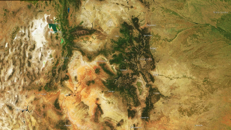
Internal estimates at Mapbox show that licensing commercial imagery equivalent to Landsat would cost $4 million per year for the base layer alone. The company would face costs beyond $4 million to produce the current cloudless basemap product, which requires more input pixels than output pixels. These costs would prohibit further development of medium-resolution products. “In other words,” Loyd notes, “we make goods with Landsat that otherwise would not get made.” An example of a cloudless map derived from Landsat is shown in Figure 1.
Figure 1. Example of a cloudless image of the western states in the U.S., composed using Landsat. Courtesy of Mapbox.
A great example of government undertaking a task that is beyond the reach of any individual and most enterprises. A task that results in data that can be re-used by others for a multitude of purposes.
Kudos to Mapbox and the USGS (US Geological Survey)!
If you are not familiar with the resources available from the USGS (US Geological Survey), you are in for a real treat.