From: The evolution of Ordance Survey mapping:
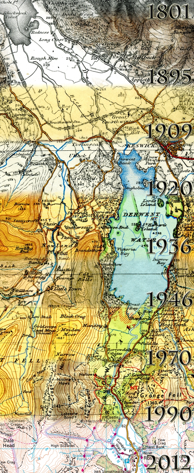
If you’re a lover of old maps, you may be aware of the changes that have taken place on Ordnance Survey maps over the years. Changes to colour, styling, the depiction of roads and vegetation for example. As you can imagine, visitors to our Southampton head office often want to visit our Cartography teams and see the work they’re doing now – and compare this to how things used to be done.
The Cartography team put their heads together and came up with a display to show visitors the past present and future roles of cartography. One aspect of the display was produced by Cartographer Alicja Karpinska, making use of her photography and digital image manipulation skills, to complete an image showing the evolution of Ordnance Survey mapping.
See the post for more details.
Assuming that topic maps recur in particular subject areas, a similar evolution of mapping is a distinct possibility at some point in the future.
Indexers map properties to subjects every day so topic map can’t claim to be the first to do so.
However, topic maps are the first technology that I am aware of that makes that mapping explicit. That a rather important difference and is crucial to supporting an “evolution of mapping” for topic maps at some point in the future.